Products
3D Perspective and Shaded Relief Wall Maps
Wall maps can be ordered with or without frames. Custom maps can be requested and made available. Please submit a request through the contact page.
3D Perspectives of Monterey Bay
20 x 16 inch color poster, unique view of the underwater canyon. Satellite imagery is draped over surrounding topography. Available in a variety of frames or unframed.
View and customize poster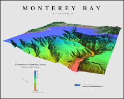
3D Perspectives of San Francisco
20 x 16 inch color poster, unique 3D views of the city and surrounds using elevation data, satellite imagery, and topographic data. Available with a black or grey background and in a variety of frames or unframed.
View and customize poster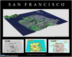
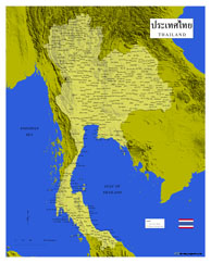
Thailand
20 x 16 inch color poster. Custom shaded relief map of Thailand and the surrounding area. The map includes Provinces, cities, towns, and villages. The Province names are written in Thai characters. This is a one of a kind map.
View and customize poster